Annotate a drawing or a map
The Annotate mode is for doing a take-off and adding remarks directly on a drawing or a map, on your own layers. It does not touch the drawing or the tasks.
For a one-off measurement, with nothing saved, the Measure button is enough.
Open the Annotate mode
- Open the drawing or map.
- Click the Annotate button, shaped like a pencil.
- To leave, click Done, at the top of the panel.
Tasks and points of interest are hidden while you annotate. On a drawing, lengths and areas are only calculated if Touch2build knows its scale. If no scale is found on the drawing, a box lets you enter it (for example 1/50) or click the two ends of a known distance and enter its real length. The scale then applies to the whole project. You need the permission to edit drawings.
Layers
Each annotation belongs to a layer, with a name and a colour. Before drawing, create a layer with New layer, for example one per package.
- Private or shared
- A layer is private at first. Click its private or shared label to change it. A shared layer is visible to the project, but only its author can edit it.
- Show or hide
- The eye hides the layer while you work.
- Outside the Annotate mode
- In the drawing or map, the layers button has an Annotations section. Layers are hidden there by default: tick the ones you want to see.
Tools
Choose the tool in the top bar, or with its key. Type a label before drawing: measurements with the same label are added together in the take-off.
| Tool | Key | Use |
|---|---|---|
| Select | V | Click an annotation to edit it |
| Length | L | Measure between two points |
| Polyline | P | Length over several segments |
| Area | S | Click the corners of the zone |
| Rectangle | R | Two opposite corners: width, depth and area |
| Cut out of an area | H | Draw a zone to take off: shaft, opening… |
| Cadastral parcel | K | On a map only |
| Wall area | M | Wall length multiplied by its height, openings deducted |
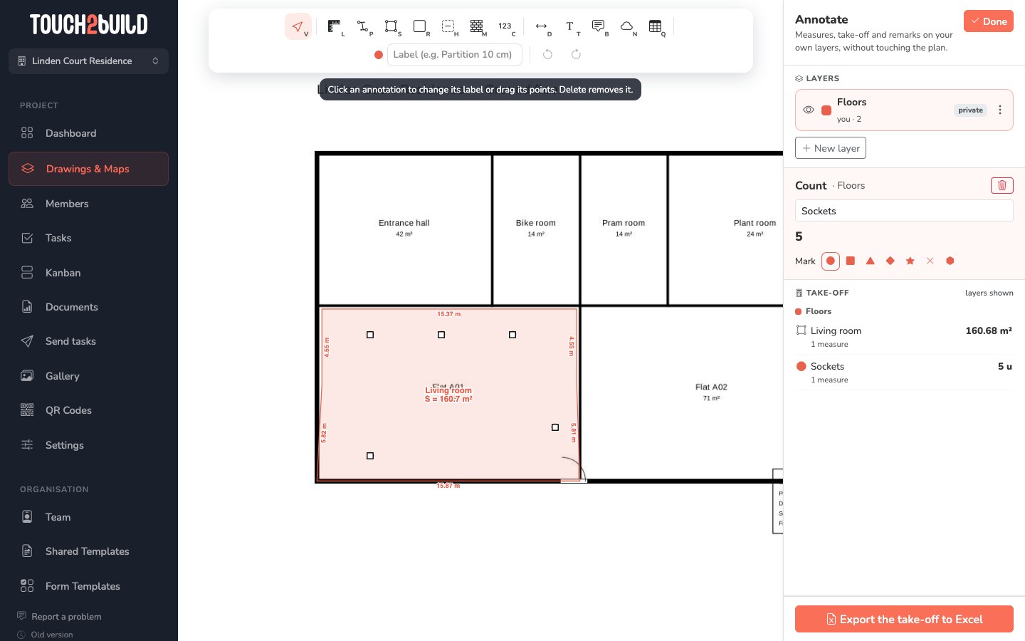
| Count | C | One click per item, Enter to finish |
| Dimension line | D | A dimension line with its length |
| Text | T | Click, then type directly |
| Callout | B | A text linked to a point |
| Revision cloud | N | Two opposite corners of the zone to circle |
On a vector drawing, the pointer snaps to the corners and intersections of the lines.
Ctrl+Z undoes, Ctrl+Shift+Z redoes, and Del deletes the selected annotation.
Edit an annotation
With the Select tool, click an annotation. The panel lets you change its label, what is shown on the drawing (title, area, length, each side…) and the text size. Drag a point to correct the outline.
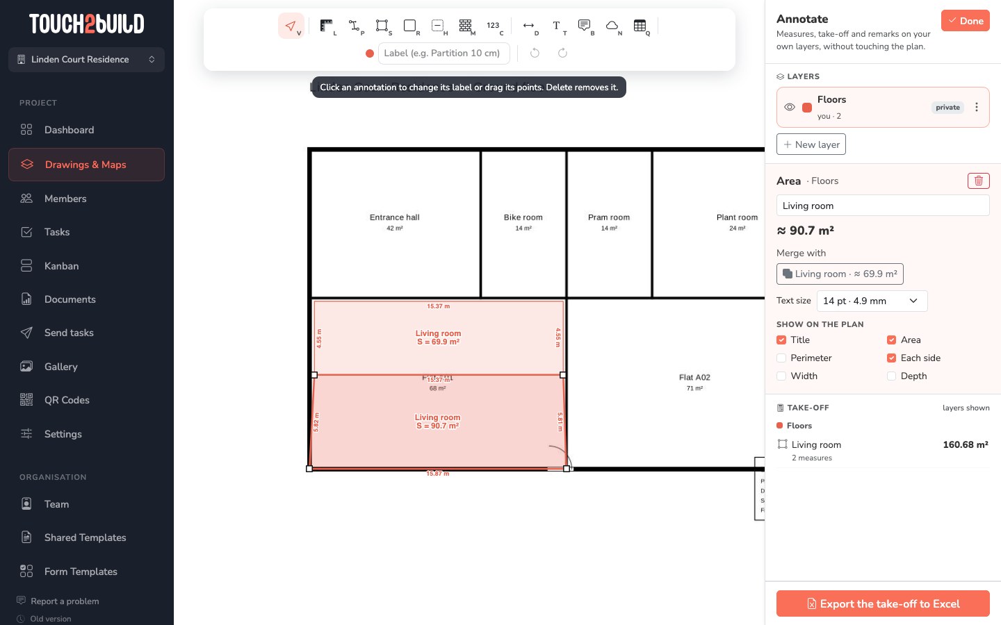
Merge two areas
When an area touches another one on the same layer, the panel shows Merge with and the list of neighbouring areas. One click joins the two into one, which keeps the label of the selected area. The overlap is counted only once, and a small gap between two hand-drawn zones is closed.
If earthworks had been calculated, you will need to run them again.
The take-off
The Take-off panel adds up the measurements of the layers shown, by label. Excel exports this table.
Export to PDF
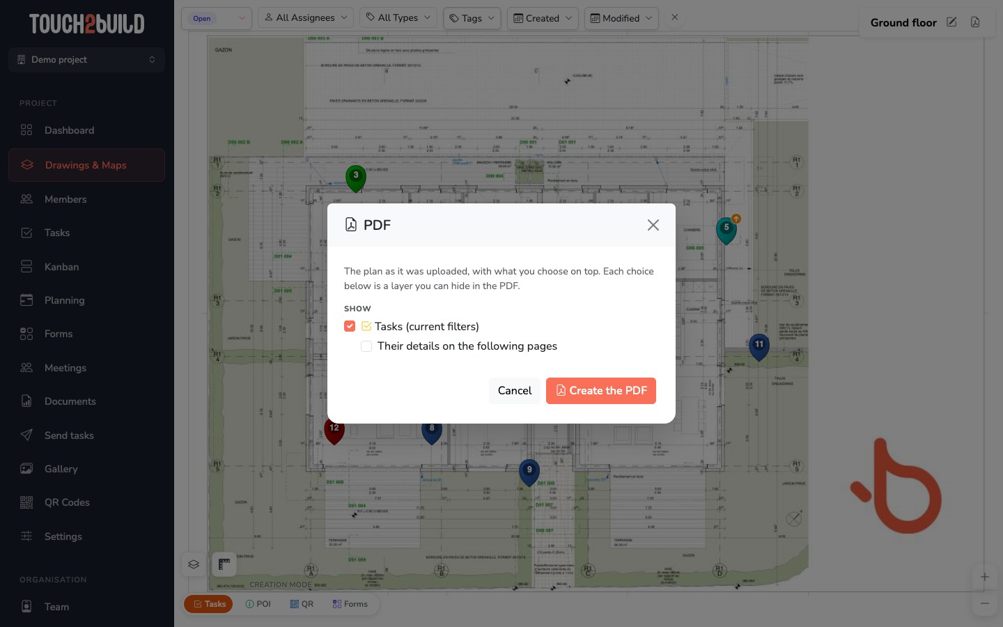
Outside the Annotate mode, the PDF button of the drawing or map opens a choice: the tasks, with or without their detail, the points of interest and each annotation layer. On a map, also choose the format (A4 or A3) and the orientation: the printed area is the one shown on screen.
Each item becomes a layer of the PDF, which you can hide in a reader such as Acrobat. The file arrives in Documents, among the exports.
On a map
Measurements are made on the ground, with no scale to set.
- Cadastral parcel
- Click a parcel to pick up its official outline, its reference and its area. A second click removes it. Covers Belgium, France, Luxembourg and Switzerland.
- Follow streets and paths
- With the Polyline tool, the route can follow the streets between your points.
- Elevation profile
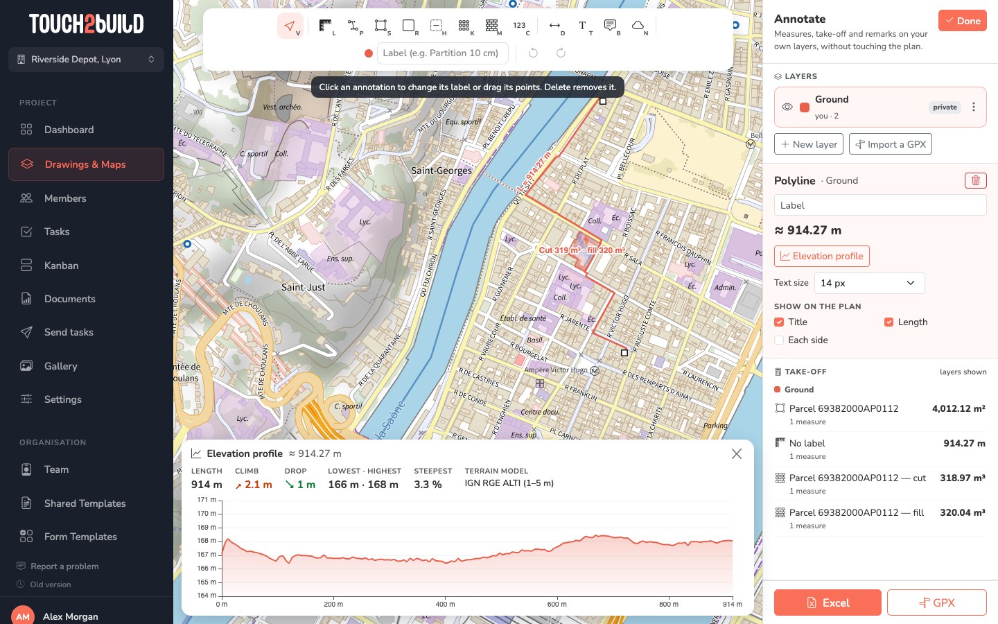
- Select a line and click Elevation profile: length, climb, drop, lowest point, highest point and steepest slope.
- Earthworks
- Select an area and run the calculation. Choose the Platform level to get the cut and fill, with a coloured map. Create a task copies these figures into a new task.
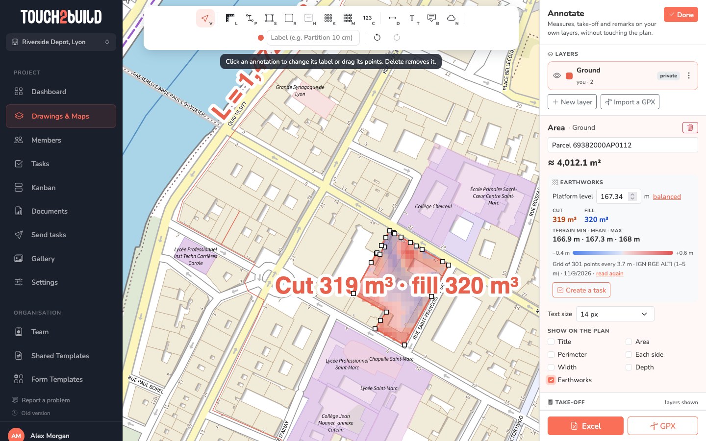
- GPX
- Import a track into the active layer with Import a GPX, or export the layers shown.
Accuracy of the terrain
Altitudes come from public models: 50 cm in Wallonia, 1 m in Flanders, 1 to 5 m in France, 2 m in Switzerland, and a worldwide 90 m model elsewhere. Earthworks are an estimate: they do not replace a surveyor's survey.